About Us
Who We Are
Who is LibanCiel sarl ?
LibanCiel sarl is a Lebanese firm which is specialized in GIS-Geographical Information System, Photogrammetry, Remote Sensing, 3D Modeling and Animation in addition to the Green Buildings. It was founded with a vision to provide an advanced, innovative and professional Engineering Services.
What kind of Services can our company provide ?
We can assist in different GIS-Engineering Services e.g: To Scale Cartographies with High resolution, Up-To-Date, Geo-referenced and Ortho-rectified Aerial Imageries along with Contour Lines / Elevation Points drawings for large areas. In addition, we can also generate 3D Models (Design & Reality) in a professional and impressive way.
Who can take Benefit from our services ?
- Ministries
- Municipalities
- Consultants
- Engineers
- Contractors
- Architects
- Interior Designers
- Real Estate Developers
- Residential, Commercial and Industrial (Green Bldgs)


What We Do
Libanciel sarl is specialized into four sectors:

1.1- Generating Geo-referenced, Up-to-Date, To Scale, Orthorectified and High Resolution Aerial Imageries (Resolution: 4…10 cm/px, down to 1 cm/px for special applications)
خرائط جوية حديثة ذات جودة عالية و مطابقة مع الواقع كما مع خرائط المساحة
1.2- Generating Contour Line / Elevation Points every 1 to 10 meters which are perfectly Overlapped with the Aerial Imageries ( Average Accuracy: Less than 20 cm )
خريطة جوية مع الشقلات / مناسيب
All The aforementioned generated Drawings along with the Infrastructure drawings ( Electricity, Lighting, Water, Sewage, Telephone, Poles, Manholes etc…) can be visualized through AutoCAD (CAD Software), ArcGIS, Google Earth, iOS (iPhone, iPad) | Android Applications.
2.1- The dedicated GIS/Database Software permits to perform geospatial analysis and visualize all the required layers like Aerial Imagery, Contour Lines, Cadastral, Infrastructure drawings along with a complete Geo-referenced / Geospatial Database Features which includes and not limited to: Coordinates (Latitude and Longitude), Name, Family, Mobile/Landline Numbers, Nationality, Paid, Date of Construction, Classification, Type, Word / Excel files, Photos, Videos… or any other defined attributes in an easy and user-friendly ways.
Thus; Searching and Locating any Feature ( e.g: Citizen مكلّف, Landmark, POI-Point of Interest معلم ما…) by any of the above mentioned Attributes (e.g: Name, Number, Nationality etc…) thru this dedicated GIS/Database software is viable, reliable and convenient for any User.
2.2- iOS | Android Application: Wherever you are, our compatible Data with iOS | Android App shows you all the Drawings, Aerial Imagery-Orthophoto, Cadastral, Contour Lines, Infrastructure drawings and POI on your smartphone in a soft and cozy way.
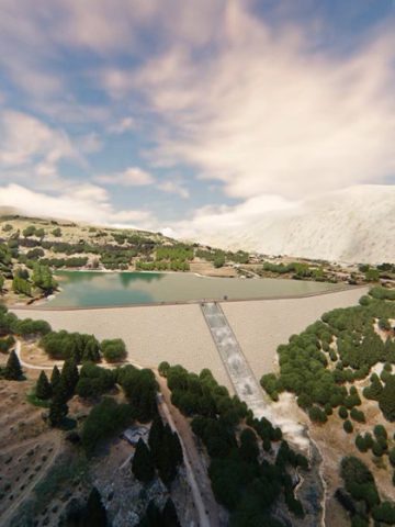
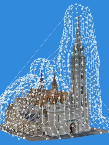
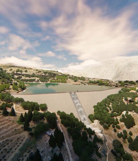
We do true scale Outdoor 3D Reality Modeling for existing Archeological sites, Places of Worship and Buildings etc…by using a drone or converting 2D Plans/Designs into 3D Models… in addition to the City 360 Panoramic view (Bird Eye 360 x 180 deg).
The construction phases of any project can be done through an Animated Phasing Video.
Creating professional and sophisticated 3D Animation to reflect any Idea or Study. Here is a Sample
A New Way for presenting / promoting your 3D Projects (either Design or Reality Models) instead of sending PDF or PowerPoint static files in 2D !
You can live the Experience of visualizing your projects in 3D by using the VR/AR Headsets or even your iOS device (iPhone / iPad).
Solar Photovoltaic Systems. A Free sustainable Energy from the SUN
THE CORE ACTIVITIES of libanciel
– Geo-referenced, Up-todate, Ortho-rectified Airborne Imageries for Any CAD Software, ArcGIS, Google earth and Iphone / iPad / Android App.
Accurate Measurements like: Distances, Perimeters, Areas, Volumes, Slopes, Directions and Elevations can be done.
– Smart Maps: GIS-DATABASE Link (Queries by Attributes based on Oracle or Excel data + Performing geospatial analysis).
– 3D Reality Modeling (Cities, Reliefs, Factories, Places of Worships / Tourisms, Architecture / Historic Buildings, Archeological sites and Cultural Heritage…)
– Virtual and Augmented Reality of any new project to visualize it in 3D at the design stage (e.g: Bridge, Interchange, Dam, Castle, Villa, Mall…)
– Animating the construction progress through an Animated Phasing Video.
– Corridor Mapping (Roads, Highways, Waterways-Rivers, Railways, Shorelines, Pipelines-Oil and Gas, Power Lines …).
– Digital Elevation Modeling-DEM, DSM, DTM, Contour Lines /Elevation Points and Slopes.
– Generating Watersheds, Viewsheds.
– Thermographic Imaging.
– LiDAR (Laser) Scanning.
– Mining and Quarry Management (Monitoring and Controlling Stockpiles, Excavations, Area and Volume precise measurements)
– Waterway and River Monitoring (Breaches)
– Agriculture: Detecting Crops Health plus Aerial spraying in an accurate & professional ways.
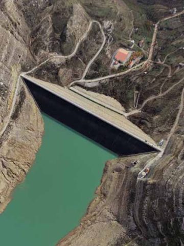
– Construction progress Monitoring (Cities Development, Huge projects, Highways, Dams, Compounds and Complexes etc…)
– Outdoor and Indoor 360° Panoramic Views (Bird Eye view) Spherical Photo 360×180 deg
– 2D and 3D Animations
– Telecom Tower and Power-Line Inspections
– 3D PowerLines detection with accurate coordinates (X|Y|Z). Deliverables can be in .dwg, .kmz, .shp or any other format.
– Photovoltaic Solar Panel Installation, Inspection and Detection of defected Panels
and many more …
libanciel's Accomplished Projects in Lebanon:
Ministry of Energy and Water
Kornet Chehwan, Ain Aar, Beit Kiko and Hbous – Mtein and Mchikha – Beit Merry
Jdeideh, Bawchriyeh – Hazmiyeh – Furn Chebak, Ain Remaneh – Borj Hammoud
Aabra – Maghdoucheh – Saida – Chtoura – Ghazir – Halat – Hosrayel – Falougha, Kfour …
Platinum Holding – Hazmiye
libanciel's Accomplished Projects in KSA:
3D Modeling Interactive Walkthrough
libanciel's Manager Accomplished Projects in Qatar:
Solar Photovoltaic Systems: Full replacement of Diesel Generators of more than 10 sites in the Desert of Qatar (Avg 20 KW per site with a Battery Autonomy of 5 Days )
Why Us
Our aim is to meet our clients needs, even more than their expectations, in ways that are Economically and Technically viable

- Creative Ideas and Competitive Prices
- Higher Quality
- Higher Accuracy
- After sales Backup and Fast Response
- Transparent and Trustful relationships
- Professional Engineering Services
- Continuous tracking for Innovations and Exploration of the unknown
- Payment facilities
Satellite Vs LibanCiel
Aerial Imageries and Elevations

Contact
- +961 3 456 157 (LB)
- +966 55 9613695 (KSA) *W.A Only
- [email protected]
- Zalka, Beirut-Lebanon
© 2022, All rights reserved, Developed By A.A
